![]()
The first Ski-O of the season is coming up soon! It will be Sunday, January 18th with starts from 10 a.m.-11:30 a.m. All competitors must finish by 12:30 p.m. (Our permit expires then and controls will be pulled!)
The Long course will have 12 controls and is 6.9 km. It includes groomed ski trails, single-track trail, and social ski and footpaths.
The short course will have 7 controls and is 4.9 km. It can be completed entirely on groomed ski trails and is a good introduction to the sport.
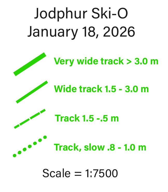
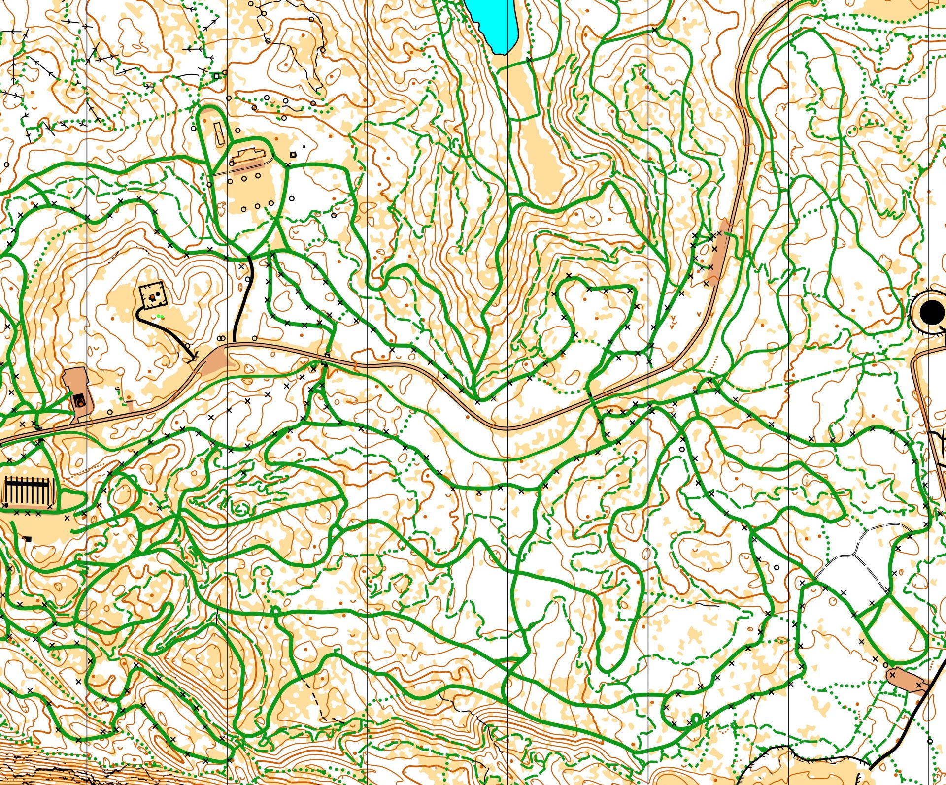
Ski-O maps look different from traditional orienteering maps. Trails are marked in green and there is no vegetation mapped, since competitors generally stick to the trails, though you may risk a bushwhack if you’d like. Below is a sample of the map in the area that the event will be held as well as a guide to the trail symbols. For our map, the thickest line means a groomed skate trail, the thinner line is a groomed classic trail, a dashed line is a single-track trail and dotted lines are social ski and footpaths that may or may not appear, based on recent traffic. There is also a rarely used grey line that shows a wide ungroomed trail.
Another map difference is that clues are not printed. All controls are on trails. Control numbers include both the sequential number of the course and the control ID number. For example 9-50 means the 9th control and the electronic punch will be number 50.
Ski orienteers may go any direction they want on the trails. We have special dispensation from NSAA to do this. Long course competitors will be using the classic only Horseshoe Loop. Do your best to respect classic tracks if you skate any part of the system.